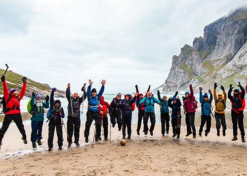
About this Trail
I recommend Sespe Hot Springs as a 2 - 4 night out-and-back trip. Make sure to spend at least one night at the amazing camp spots at the springs (two spots are shaded by large palms - winter paradise!). Best to visit in fall or winter so temperatures are comfortable and there is ample water (summer in the Sespe is hot and dry). We went in December.
You'll start at the trailhead to the left of the bathrooms at Piedras Blancas, hiking east. You'll walk through the chaparral and sparse pine landscape, passing opportunities to camp at Bear Creek (large sandbar with plenty of trees for shade), Oak Flat (large oak trees, great swimming hole, and a picnic table), and Coltrell Flat. You can also camp at Willett, though we found the camp to be crowded - 3-4 small groups - and pushed on.
We were not disappointed - Sespe Hot Springs is beautiful, as was the hike to get out there!

Before Sespe was designated as wilderness in 1992, there was a road to the springs, so hikers may seem unexpected things near the overgrown road - among other things, we saw a rusted car side mirror, barely visible in the dry grasses!
I highly recommend purchasing
Tom Harrison's Sespe Wilderness map for this route - link below!
Directions to Trailhead (or put-in on water trails)
The Piedras Blancas trailhead for the route described is in the Ojai Ranger District of Los Padres National Forest. Piedras Blancas is a relatively popular geological site to visit, so parking is ample and there are facilities at the trailhead. One could also take the Johnston Ridge Trail from Mutau Flats (9.5 miles, 2,000 ft elevation change with no water), but that's not the route I describe here.
Notes on Difficulty Rating
It is 15.5 miles to Sespe Hot Springs from Piedras Blancas, passing Willett Hot Springs at mile 9.5. The trail crosses Sespe Creek about 8 times (depending on water levels) before arriving at the gorgeous springs! The first 4.5 miles from Piedras Blancas to Bear Creek Camground are flat and wide, with minimal creek crossings; then, the trail narrows and has some gradual ups and downs. Depending on seasonal water levels, parts of the last 2-3 miles may be less defined due to seasonal flooding washing away the trail. However, hikers can follow along the warm creek all the way to the springs.
